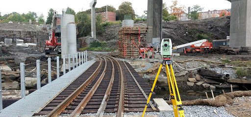
RAILWAY HIGHWAY & ROAD SURVEY:
A railway project should be implemented in different stages, as described below:
Justification of Constructing New Line
A When the question of constructing a new railway, Road line between some places arises due to public demand or some other reason, an intensive study is carried out as regards viability of the project:
- The following points should be kept in mind while considering the justification of constructing a new line.
- Total population of the villages, towns, industrial places, etc, coming –under the project, should be recorded.
- The standard of living and habits of the population, and the economic conditions of the locality, should be thoroughly studied as it will be a source of revenue for the department.
- The amount of agricultural, natural and industrial resources should be recorded.
- Information regarding religious places, religious fairs of festivals, business centers, etc. should be noted.
- The amount of revenue that may accrue from passengers, agricultural goods, industrial goods, natural resources, etc. should be estimated.
- A topographical map should be studied to determine the number of culverts, bridges, level crossings, tunnels, etc.
- An agricultural map should also be studied so that too much valuable land is not affected.
- A contour map should be studied in order to ensure economical alignment, avoiding unnecessary cutting or filling and maintaining a permissible gradient.
- An Industrial map should be studied to find the shortest route to connect industrial areas.

Marking of Tentative Alignment
After the decision to set up a new railway line, Road is taken, tentative alignments of alignments are marked on the contour map and topographical map for the area concerned. While marking the tentative alignment, the following points should be kept in mind:
- The route should be the shortest possible.
- As far as possible, it should follow the ridge line to avoid unnecessary earth work in filling.
- It should cross rivers perpendicularly.
- It should not pass through religious places, such as temples, mosques, churches etc. or burial grounds, burning ghats, and soon.
- The route should not pass through the centers of villages, towns, valuable structures, etc. where the compensation payable is likely to be more.
- It should not be too zigzag, so that the number of curves is minimized.
- It should not cross large depressions or valleys, high summits or ridge lines, to avoid huge earth fillings in areas of depression and tunneling in regions including summits.
- The tentative alignments of two routes should be marked for comparing costs of construction, feasibility, advantages, etc.
Selection of Good Alignment
After reconnaissance survey, a good alignment or alignments are selected for preliminary detailed survey.
Detailed Preliminary Survey
After selection of suitable alignment of alignments, a detailed preliminary survey is conducted. Such survey should be extremely accurate as selection of the final alignment depends on it.
Preparation of Estimate
- Earth work required in cutting and banking is estimated.
- A mass diagram is prepared fro balancing the cutting and banking operations.
- An approximate estimate is done for culverts, bridges, levels crossings, etc. (A final estimate is prepared after the design.)
- A compensation list is prepared showing full details.
- A detailed costing of the project is then prepared for inclusion in the project report.
Final location Survey
The alignments considered in the preliminary survey, the most economical is selected. Before the approval of the project, the final location survey is completed in all respects. This survey helps the engineers in charge of construction projects.
Project Report (DPR)
After completion of all survey work, Estimation a project report should be prepared and submitted for approval.

